

Ernesto made landfall in Bermuda as a hurricane on Saturday, bringing “hazardous weather” to the Atlantic island before weakening to a tropical storm along its exit path.
The hurricane made landfall on the island at around 4:30 a.m. Atlantic Standard Time as a Category 1 storm, the National Hurricane Center said. By 11 p.m. the storm was headed away from the island toward the north-northeast at a casual pace of 8 mph, the center said.
It was about 140 miles northeast of the island nation early Sunday.
The storm’s hurricane-status, maximum sustained winds of 75 mph had calmed slightly to 70 mph, but federal forecasters said Ernesto could regain strength amid the open ocean waters.
“Some intensification is possible Sunday and Sunday night, and Ernesto could regain hurricane status,” the hurricane center said in its latest bulletin on Ernesto. “The cyclone will likely become post-tropical near southeastern Newfoundland by Monday night or Tuesday morning.”
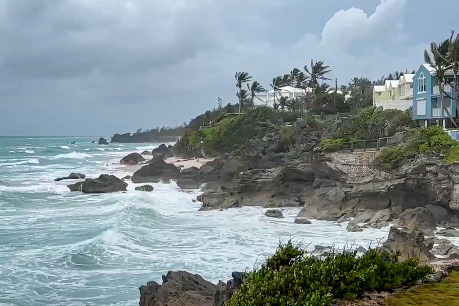
A tropical storm warning is still in effect in Bermuda, where 7 to 9 inches of rain may produce “life-threatening” flash flooding, especially in low-lying areas, the hurricane center said. Flooding along the coast is also possible on the island, paired with “large and destructive waves.”
“Hurricane-force gusts are possible on Bermuda for a few more hours,” the hurricane center said. “Tropical storm conditions are likely to continue through this evening or tonight.”
The current slow motion of the hurricane is expected to continue through early Sunday, with an acceleration toward the east-northeast expected later in the day.
“On the forecast track, the center of Ernesto will slowly move away from Bermuda today and pass near southeastern Newfoundland late Monday and Monday night,” the hurricane center said.
In a statement, the government of Bermuda warned that although the eye of the storm has moved north of the island, the southern eye wall is still expected to make its impact.
“Do not be fooled by winds not ramping up quickly… we still have the 2nd half of Ernesto set to move over us,” the government said on X.
Over 26,000 utility customers do not have power in Bermuda, representing about 72% of the island, according to local officials. In a news briefing, Michelle Pitcher, director of the Bermuda Weather Service, told residents to be mindful of the hurricane-force winds the island will be experiencing for the rest of the morning.
“And then it looks like winds will be decreasing throughout this afternoon. However, we’re still going to have strong tropical storm-force winds until closer to this evening,” she said.
There have not been reports of any major damage in Bermuda yet, officials said, but emergency services have also been on limited patrols due to the strong winds.
Video captured by an NBC News crew in Hamilton, the island’s capital city, showed some debris, including downed palm fronds and tree branches, but no damage to buildings. In Southhampton, strong winds could be seen blowing through the palm trees. There were also downed trees, power lines and branches in the area.
Dangerous beach conditions, including large waves and rip currents, were expected along the East Coast until early next week. National Oceanic and Atmospheric Administration buoys overnight measured waves of 7 feet off Cape Hatteras, North Carolina, and 6 feet off Montauk Point, Long Island.
New York City officials concerned about storm-agitated rip currents said Queens and Brooklyn beaches are closed to swimming through the end of the day Sunday for now. Authorities herded people onto dry sand on Saturday.
“They were suddenly ushering people out of the water,” Coney Island beachgoer Felia Wiliams of Astoria told NBC New York.